
Description
Overview & Capabilities
•Three integrated detection systems:
1.Long‑Range System – for wide-area scanning
2.Geophysical Search System – detailed subsurface analysis
3.3D Imaging System – visual mapping of water layers  
•Detection range:
•Depth: up to 1,500 meters underground
•Front / horizontal range: up to 3,000 m² scanning area 
•Water characteristics analysis: distinguishes water type (fresh, salty, very salty), measures density and salinity, and identifies the easiest digging locations .
•Terrain adaptability: supports targeting across 6 soil types—rocky, natural, mixed, mineralized, clay, and sandy—and can display the proportion of rock in the scan area .
⸻
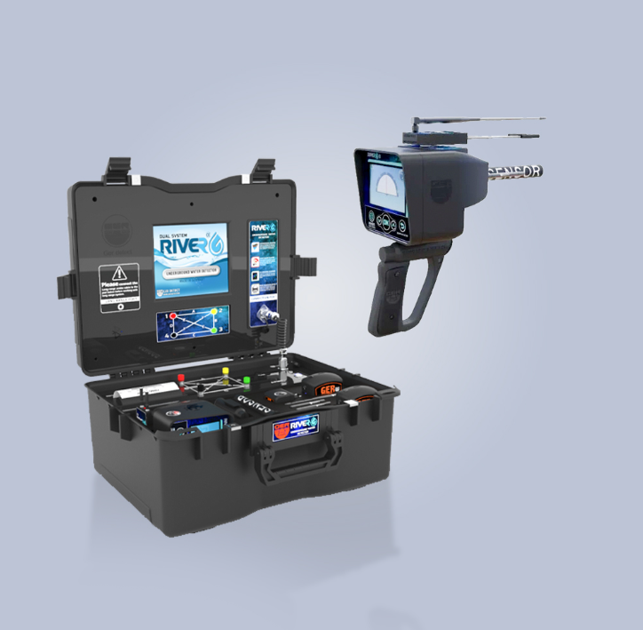
📱 Device Layout & Interface
•Long‑Range System unit:
•4.3″ full-color high‑resolution display with touchscreen and keypad control.
•Built‑in digital compass to guide navigation.
•Supports six languages: German, English, French, Spanish, Italian, Arabic .
•3D Imaging System:
•8″ Android-based tablet with touchscreen to present 3D maps of water and rock formations.
•Generates pie‑charts showing water density vs. rock and salinity  .
•Geophysical System:
•Main unit with high-speed processor, 500 cm probes, and built-in printer that prints results on‑site.
•Provides real‑time depth, density, salinity, and water type readings .

Reviews
There are no reviews yet.